Geology – Experimental facilities
Our analytical work partly relies on the analytical platform of the Center of Geosciences, managed by the “Experimental Facilities” support team. Here are some equipment the team takes benefice from.
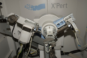
X -ray Diffraction analyses (XRD): X’Pert Pro (Philips)
Scientific manager: C. Franke
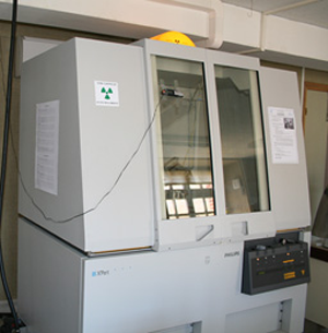
X’Pert Pro (Philips)
|
X-ray diffraction analyses may be performed on:
Applications: Metallurgy, caracterization of mining or petrolium ressources, (paleo)climate and (paleo) environmental studies, valorization of (geo)materials, caracterization of anthropogenic anorganic phases in sediments, caracterization of mineral alterations, etc.
Analytical protocol: Bulk rock: Clay mineral fraction: |
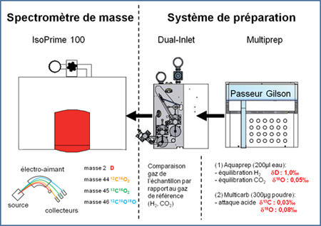
Mass Spectrometer for isotopic analyses of carbonates (δ18O, δ13C) and water samples (δD, δ18O) : Isoprime 100 (Elementar)
Scientific managers: D. Huyghe (carbonates) / S. Guillon (water samples)
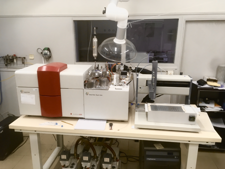
Isoprime 100 (Elementar)
Analytical setup |
Instrumental setting: Isoprime 100 (Elementar) Dual Inlet
Our mass spectrometer may be employed either on carbonate (aragonite or calcite) or water samples. These analyses are applied to different topics: Carbonates:
Water samples:
Analytical protocol : Rock samples: 100 to 200 µg of homogenized powder sample for pure carbonates Water samples: Volume: 200 µL of non-filtered water (may contain volatile compounds or dissolved salts). Equilibration with CO2(g) (resp. H2(g) with Pt catalyzer) during 7h (resp. 4h) at 40 °C. Participation in the GNIP network of isotope record of precipitations. |
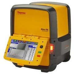
X-ray fluorescence spectroscopy (XRF): portative XRF sensor (Olympus INNOV X Delta Premium, commun instrument of the FIRE) and laboratory XRF sensor (Niton FXL)
Contact: C. Franke
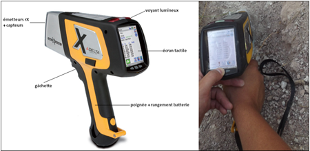
portable XRF sensor Olympus INNOV X Delta Premium
laboratory XRF sensor Niton FXL
|
(analysable elements : Mg to Bi) The XRF analysis results in a (semi)quantification of the major element (%) and trace element (ppm) composition in rocks/minerals and synthetic anorganic materials. The samples can be analyzed as dry bulk powder (some 10th gram) or a 2×2 cm solid sample with plane surface. There are mutiple applications of the XRF technique, wich are complementary to the mineralogical DRX analysis: Metallurgy, caracterization of mining or petrolium ressources. (paleo)climate and (paleo) environmental studies, valorization of (geo)materials, caracterization of anthropogenic anorganic phases in sediments, caracterization of mineral alterations, etc.
|
Differentiel GPS: Leica Zeno 20 Android
Contact: J.L.Grimaud
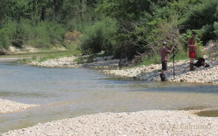 |
DGPS measurements allow realizing topographic surveys whose accuracy can be improved directly or using post processing by removing the ambient noise. The accuracy is generally of several decimeters and can go down to the centimeter depending on acquisition duration and satellite cover.
DGPS measurements are used for different purposes:
Measurement protocol : |
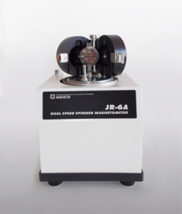
Magnetism laboratory: magnetic susceptibility meter (Bartington MS3) and Spinner magnetometer (AGICO-JR6)
Scientific manager: C. Franke
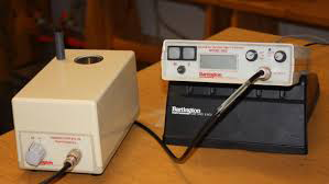
magnetic susceptibility meter (Bartington MS3)
Spinner magnetometer (AGICO-JR6) |
These instruments allow the analysis of the magnetic suscetibility of different solid samples, such as rocks, sediments, plants etc. in the laboratory and in the field. The analysis of the magnetic susceptibility is applied in the framework of (paleo)environmental studies (e.g. tracing of ferruginous minerals or metallic particles). The Spinner magnetometer serves to recover the natural remanent magnetisation (NRM) of oriented rock samples from palomagnetic studies.
|